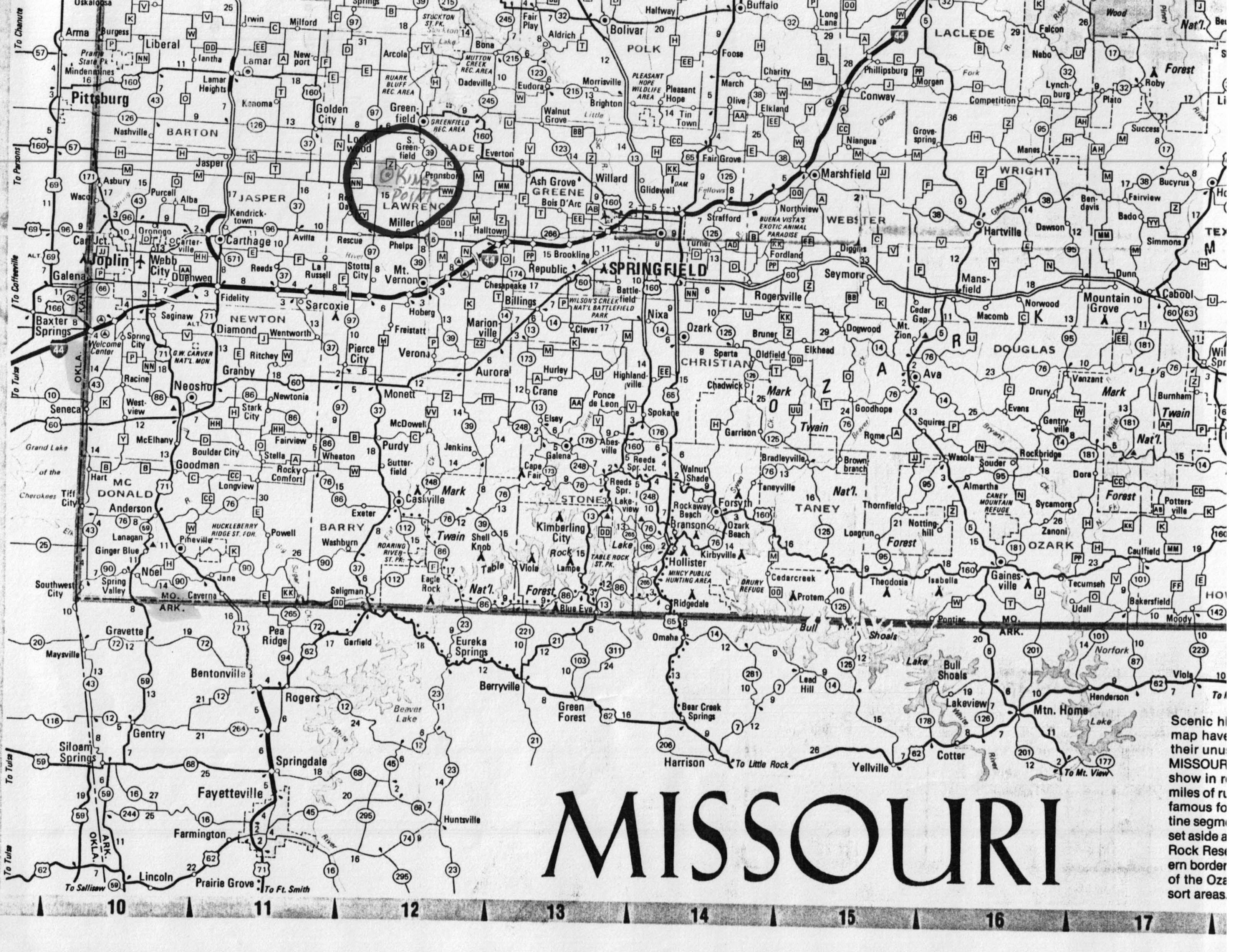
KINGS POINT, MISSOURI
This all took place on our return trip from Minnesota on May 27, 1988. We left Springfield, Mo. for Greenfield, Lockwood and hopefully Kings Point. The country is flat to gently rolling farm land. There is some evidence of sprinkler irrigation however it is mostly "dry farming". Beef cattle (Herefords and some Angus), pigs and dairy herds are common with a few horses noticeable. Crops of corn for silage, hay (alfalfa and grass) for hayage (this is a Minnesota term), some oats and wheat. There are some limestone outcrops of a dull grey color where weathered. We passed a limestone quarry where all sizes of limestone products are sold. One common usage of the small pebbles is to embed them in the asphalt road surface which makes a very nice smooth light colored surface for driving. This really must provide an easily seen surface for night driving on the narrow country roads. Reference Map.
We drove west on state highway 160 from Springfield, through Greenfield to Lockwood, Mo. and drove up and down Main street taking pictures. There were several old buildings and a few new ones. The town is small, with an east-west railroad dividing what we saw of the town. We stopped at the Magnolia House for lunch. The Magnolia House is a combination antique/crafts shop and restaurant. Jennifer Morris operates the crafts portion and Mary Lasater runs the diner plus being in real estate. While browsing in the crafts shop I inquired of Jennifer Morris if she knew of Kings Point and she said "of course". It turned out that she belongs to a genealogic group from the Greenfield, Mo. area. She gave us directions to where there is a Kings Point Baptist church and the Kings Point cemetery.
The directions were as follows: Go south on Main street (County highway 97) 4 miles to the S & H Farm Supply building on the right. At this intersection County road A proceeds westerly and County road Z proceeds easterly. We proceeded east on Z for 1 mile until we saw a sign on the right pointing south to Kings Point Baptist church 1 1/4 miles down a gravel road. At about a mile another road from the east butted into the road we were on. At the SE corner is a boarded up one story building with a rather weathered sign Kings Point Grocery and the proprietor’s name. We continued south to another T from which we saw the church to the east and the cemetery to the west. We shot a couple of pictures of the church and went on to the cemetery. The church and the cemetery are both in fairly good repair and are in use at this time. Photo Gallery
We took pictures of the church and then explored the cemetery. Near the western edge, in the older part, we located seven gravestones aligned from north to south as follows:
|
MARGARET L. KING S. N. KING died April 29,1882 aged 55 yrs 9 ms 20 days |
This gravestone is of white limestone, about 2 1/2 to 3 feet high by 1 1/2 feet wide and proved to be in good shape and readable. |
|
|
|
|
|
|
|
|
|
SAMUEL NEWTON KING
born Feb 19 ? died Feb ?
Husband of
MARGARET L. KING
The dates on this stone have weathered away for the most part.
This second stone is flat on the ground, of brownish colored limestone appearing to be approximately 1 1/2 by 2 1/2 feet as initially seen. Using a pocket knife and a geology pick we started clearing away the overgrown grass which had also filled in the breaks in the stone. The original stone was about 2 by 4 feet with 6 inch wide bordering slabs.
At the foot of this marker is a rough chunk of limestone of grey color and cement-like texture about 1 by 2 feet in size with the initials B M grooved into the stone. We have no idea who or what this stone is for since it fits no names we recognize.
Continuing on to the south were, in order, three tan/brown upright stones standing about 24 inches high by 10 inches wide. These stones have no marks on their surface and may be for the three boys, sons of SAMUEL and MARGARET, who reportedly died of smallpox following the Civil War period. If so, then these stones belong to CHRISTOPHER, RICHARD, and GEORGE W. KING. Next to the third stone is another of the same tan/brown type of stone about half the dimensions of the three stones. Again this stone also has no markings on it. the seventh stone in the row is a small white limestone marker for:
NOLA
Daughter of
A.D. & M.E. HOEL
born Nov 9 1881
died Sept 19 1882
sleep baby sleep
Other graves we noted in the Kings Point cemetery
that may be of distant relatives and which piqued our interest included:
Mary E. Hoel
wife of C. E. Hoel
died Oct 17, 1875
aged 29yrs 1mo 6dys
[below this:]
Mary E. Daughter of
C.E. & M.E. Hoel
died Nov 5th, 1875
aged 1 mo.
This large single stone marked the common grave of mother and daughter. We do not believe_ that the Mary E. here is MARY ELIZABETH KING since she married Alexander Dunlap Hoel and the previously mentioned grave of daughter Nola shows she was born Nov 9,1881.
Perhaps Betty Caria has better information on the Hoel lineage which could be used to update the tree as well as this supposition.
Two other gravestones of other relatives included:
Parminter
Charles Thomas
11/14/1871 to 3/9/1952
Married 1/23/1898
Emma B: 1/20/1880
Lou D: 7/15/1962
Higgins
Parminter
John Howard
1/2/1904--4/27/1986
Married 12/27/1929 Kansas City, MO
Mary M. B: 9/26/1907
Zillig D: 5/27/1988
We did not notice any graves of the Winfield Scott Barr family that EMMA LOUISE KING married into. We had only about two hours at Kings Point but felt very excited and gratified that we had seen the surrounding countryside and the place where Grandpa KING, (WILLIAM FRAZIER) was born and raised during such tumultuous times.
To those who read this history and have information to correct or further complete the relatives history please let me know so that it can be updated.[See the Lockwood and Kings Point photo gallery here]